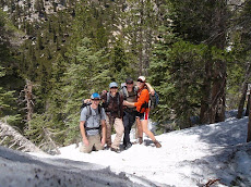
The John Muir Trail (JMT) is located in the Sierra Nevada mountain range of California. The trail runs from its northern terminus at Happy Isles in Yosemite Valley to its southern terminus, the summit of Mt. Whitney (the highest point in the contiguous Unites States at 14,505 ft). The official length of the JMT, according to the United States Geological Survey, is 211 miles. From the southern terminus of the John Muir Trail at the summit of Mount Whitney, an additional 11-mile hike on the Mount Whitney Trail is required to reach the nearest trailhead at Whitney Portal, thus making an end-to-end traverse of the trail effectively 220 miles.
The elevation of the JMT rarely dips below 8,000 ft, except for the first 9 miles in Yosemite Valley. The trail crosses six passes with elevations higher than 11,000 ft (Donohue Pass, Muir Pass, Mather Pass, Glen Pass and Forester Pass). The highest of these passes is Forester Pass at 13,153 ft. When hiking north to south there is a total elevation gain is just over 46,000 ft and the total descent is just over 38,000 ft, for a total elevation change of over 84,000 ft (nearly 16 miles!).
skip to main |
skip to sidebar
Hike through the wilderness with just a wool coat and a pocket full of biscuits? Fill a rattlesnake carcass with urine and use it as a canteen? Well, we aren't that crazy... but we do go on adventures. So check out the site for info on our latest treks as we prepare for the John Muir Trail this summer!
Design by: FinalSense


